

UCL have been working on an online application to map information about the buildings of London.
The BCAAC planned to create an interactive online map showing the history and importance of buildings in Bloomsbury. However thanks to an extensive research project undertaken by UCL and today shared on Londonist, we no longer need to.
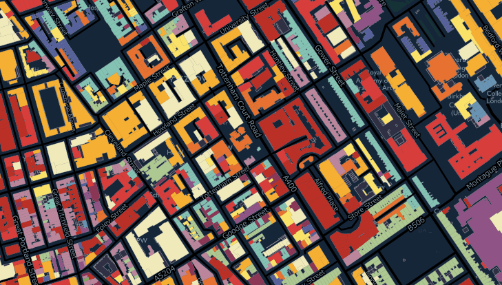
UCL have been working away on creating an online map which is open to view and edit, tabulating the age, heritage, and other details about buildings in London. It functions in a similar manner to Wikipedia, where the online community can fill in details about their own buildings.
While they intend to map all of London, thanks to being based in Bloomsbury all of Bloomsbury has already been covered.
It is a resource which we had just begun creating ourselves, but strangely enough found during our research UCL have more or less completed the work.
The excellent map can be found here.
Thanks to open access to its data, we will be working on cutting the database down to only cover Bloomsbury, and then redistribute it on the BCAAC website.
UCL have indicated that they will only be tabulating data about buildings. We are interested in the heritage and history of Bloomsbury as a whole, and so will work on extending the concept to include information about the streets and the people that live here as well.
But in the meantime UCL’s resource is an excellent place to contribute towards and learn about the buildings of Bloomsbury.
Many thanks to their research team for putting in the long hours of work necessary to implement this important resource.

We live at no. 5 Bloomsbury Square and have a pretty full history of the building
LikeLike